
Taal Volcano's Eruptive History
Taal Volcano has erupted 54 times since 1572, making it one of the Philippines' most active volcanoes.
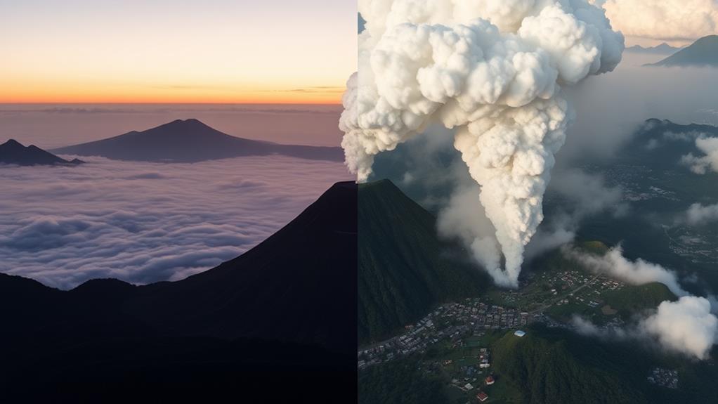
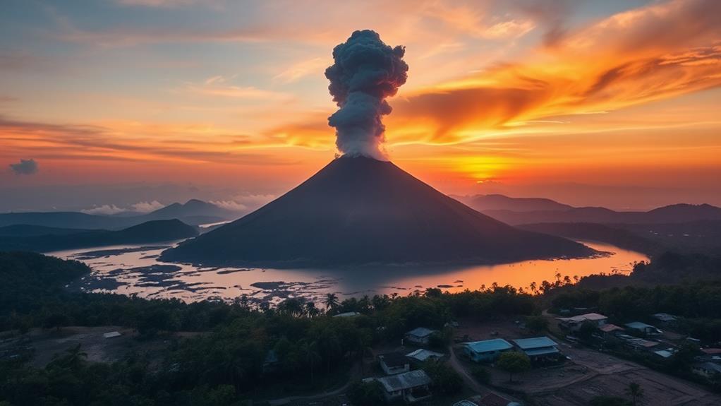
Two notable eruptions include the 1911 catastrophic event that killed over 1,300 people and the recent 2020 phreatomagmatic eruption that reached heights of 17-21 km and caused widespread ashfall.
Characteristics of Taal Volcano's Eruptions
The volcano's eruptive history is characterized by lava flows and explosive ash production, posing ongoing threats to nearby communities.
These threats are due to the volcano's ability to produce large amounts of ash and lava, which can travel long distances and affect people living in the surrounding areas.
Understanding Taal Volcano's Activity
As you examine Taal Volcano's history and hazards, you'll uncover the intricate geological processes driving its activity.
These processes include the movement of tectonic plates and the buildup of magma beneath the volcano's surface, which can lead to eruptions.
Taal Volcano's Eruptive History
Taal Volcano's Eruptive History
Taal Volcano's eruptive history began in 1572 with its first documented eruption, marking the start of a complex and volatile sequence of events.
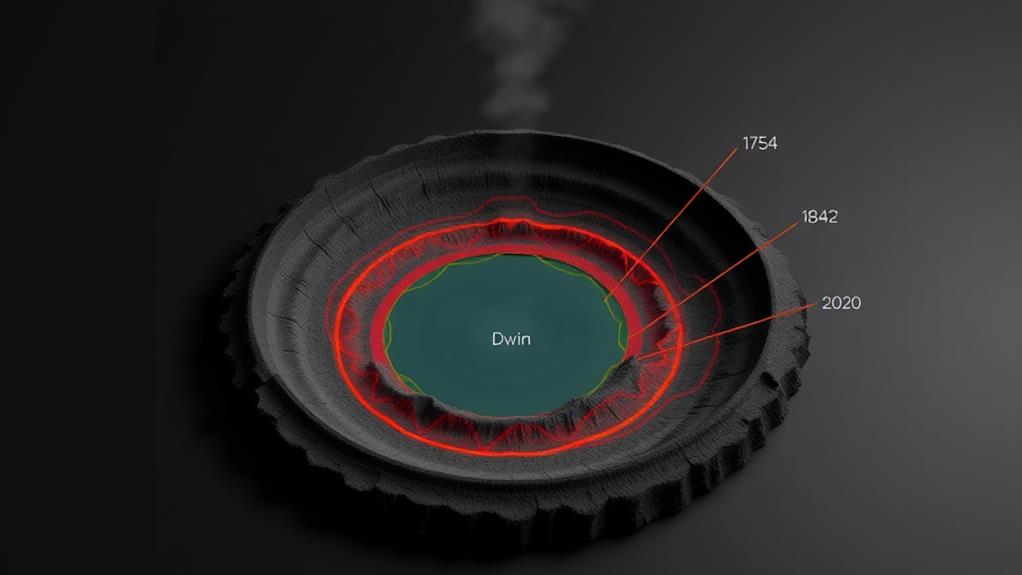
Between 1572 and 1977, the volcano experienced 54 eruptions, with notable events in 1707, 1715, 1754, 1808, and 1874. These historical eruptions have had severe impacts on local populations, such as the 1911 eruption that resulted in over 1,300 fatalities due to explosive activity and subsequent environmental effects.
The volcano's complex eruptive history includes various eruption styles, such as lava flows and explosive ash production, which pose ongoing threats to surrounding communities and ecosystems.
The most recent major eruption occurred on January 12, 2020, classified as phreatomagmatic with a Volcanic Explosivity Index (VEI) of 4, indicating a significant explosive event with mass discharge rates around 10 kg/s.
This eruption generated a plume that reached heights of 17-21 km, resulting in widespread ashfall affecting nearby communities.
Geographical and Geologic Changes
Taal Volcano's Unique Geographical Features
Taal Volcano is situated within a 25-30 km caldera on Luzon island. This volcanic island measures 5 km in length and covers 23 sq km. Its unique shape is a result of the subduction of the Eurasian Plate.
Morphological Changes Due to Eruptions
The volcano's topography has undergone significant changes due to past eruptions. The 1911 eruption caused a subsidence of 1 to 3 meters, affecting both the island and the southern shore of Taal Lake.
The Main Crater, which is 2 km in diameter, has also undergone changes.
Evolution of the Main Crater Lake
The Main Crater Lake has transformed from multiple colored lakes to a single lake. This change indicates a complex interplay between volcanic activity and geological processes.
The lake's evolution is a result of the intricate relationships between eruptions at Taal, seismic activity, and the ever-changing landscape of this complex volcano.
Understanding Taal Volcano's Behavior and Hazards
By studying Taal Volcano's geographical and geologic changes, we can gain insight into the volcano's behavior and the hazards it poses.
Understanding these changes is crucial for predicting future eruptions and mitigating their impact.
Recent Eruptions and Hazards
Taal Volcano's Recent Eruptions and Hazards
A History of Eruptions
Taal Volcano has erupted 54 times between 1572 and 1977, posing significant threats to surrounding populations and infrastructure. The most recent major eruption on January 12, 2020, generated a plume that reached heights of 17-21 kilometers, disrupting air travel and affecting local communities.
This eruption had a Volcanic Explosivity Index (VEI) of 4, resulting in widespread ashfall and the evacuation of thousands of residents.
Ongoing Seismic Activity
Significant seismic activity has been recorded, with 212 volcanic earthquakes noted recently, indicating ongoing magma movement beneath the volcano.
As of September 2023, sulfur dioxide emissions from Taal Volcano reached 3,402 tons per day, highlighting the potential for future eruptions and the need for continuous monitoring.
The Need for Awareness and Preparedness
As a resident of the Philippines, it's essential to be aware of the volcanic hazards that Taal poses to people and infrastructure.
Stay informed about the volcano's activity to ensure your safety and the safety of those around you.
Monitoring and Eruption Precursors
Monitoring Volcanic Activity
Predicting Eruptions and Ensuring Public Safety
Volcanic activity monitoring is crucial for predicting eruptions and ensuring public safety. The Philippine Institute of Volcanology and Seismology (PHIVOLCS) uses an Alert Level system to indicate the current status of Taal Volcano. This system ranges from 0 (No Alert) to 5 (Highly Hazardous), with Level 1 signaling low-level unrest and Level 4 indicating hazardous eruptions in progress.
Eruption Precursors
To predict potential eruptions, significant indicators must be monitored. These include:
- Increased volcanic quake frequency
- Changes in the temperature of the Main Crater Lake
- Ground steaming
- Elevated levels of toxic gas emissions like sulfur dioxide
For example, in September 2023, sulfur dioxide emissions reached a concerning level of 3,402 tons per day, indicating ongoing volcanic activity.
Continuous Monitoring Efforts
Continuous monitoring efforts involve:
- Ground deformation assessments
- Gas emission analyses
Updates are regularly provided to local authorities and residents about the volcano's status.
Historical alerts have included Level 1 and Level 3 notifications, prompting evacuations for communities near the volcano during periods of heightened activity.
Environmental Impact and Safety
Taal Volcano's eruptions have a devastating impact on the environment, causing widespread destruction that affects both the local ecosystem and surrounding communities.
Habitat destruction and economic losses are significant environmental impacts of Taal Volcano's eruptions. The eruptions result in the destruction of vegetation and livestock, leading to substantial economic losses and even fatalities. For instance, the 2020 eruption caused an estimated $3 million in agricultural losses.
Scalding and fatalities are major safety concerns during Taal Volcano's explosive events. Hot steam and mud can cause severe burns, which have historically been a primary cause of fatalities. In 2020, several people were injured due to scalding from hot mud and steam.
Decreased air quality is another significant environmental impact of the eruptions. Volcanic ash and gases contaminate water supplies and damage ecosystems, posing a threat to both human health and the environment. The 2020 eruption, for example, caused air quality indexes to soar, prompting health warnings for nearby residents.
Immediate threats to nearby populations are a major concern during Taal Volcano's eruptions. Pyroclastic flows, ash surges, and volcanic tsunamis can occur with little warning, necessitating effective evacuation plans to ensure public safety. In 2020, over 100,000 people were evacuated from the surrounding area due to the eruption.
Ongoing safety concerns prompt authorities to declare the area a no man's land, highlighting the need for ongoing disaster preparedness efforts. This is crucial to mitigate the risks associated with Taal Volcano's eruptions and ensure the safety of nearby communities.
What Are the Hazards Associated with Trekking to the Crater of an Active Volcano?
When trekking to mount kanlaon crater, there are several hazards to consider. The active volcano may release toxic gases and ash, posing respiratory risks. Volcanic eruptions can also produce hot gas clouds, lava flows, and volcanic bombs, endangering hikers. Furthermore, the steep terrain and unstable ground can lead to falls and injuries.
Global Volcanic Context
The Philippines is situated at the crossroads of the Eurasian and Philippine Sea tectonic plates, making it a hotspot for volcanic activity.
As part of the Pacific Ring of Fire, the country is home to numerous volcanoes.
Globally, there are approximately 1,300 Holocene volcanoes that have been active in the last 12,000 years. At any given time, 40-50 volcanoes erupt continuously.
Taal Volcano stands out with a history of at least 54 recorded historical eruptions since 1572, making it one of the 187 volcanoes noted for significant activity or impacts.
The Philippines is one of the countries with the highest concentration of volcanoes, alongside the United States, Japan, Indonesia, Russia, and Chile.
Understanding Taal Volcano's eruptive history and hazards is crucial not only for local disaster preparedness but also for contributing to the broader understanding of global volcanic processes and their impacts on climate and ecosystems.
The Philippine Institute of Volcanology plays a vital role in monitoring and researching volcanic activity, including Taal Volcano, which is situated on the island of Luzon.
Frequently Asked Questions
What Is the History of Eruption of Taal Volcano?
Taal Volcano has a history of frequent eruptions, with a total of 54 recorded events from 1572 to 1977.
During this period, there were significant eruptions in 1707, 1715, and 1911, which resulted in over 1,300 deaths.
One of the most recent eruptions occurred in 2020, generating a massive plume that reached 17-21 km and caused widespread ashfall and evacuations.
A pattern of volcanic activity is evident, with subsequent eruptions occurring in 2021 and 2022.
Historical accounts and local folklore provide valuable insights into the volcano's behavior, while geological studies and gas emissions data suggest that future eruptions are possible.
What Are the Volcanic Hazards of Taal Volcano?
Taal Volcano poses significant volcanic hazards that can be devastating.
Ashfall impacts are a major concern, as they can contaminate water supplies and damage infrastructure. For instance, ashfall can make water undrinkable and clog water treatment facilities, disrupting the supply of clean water.
Moreover, ashfall can also corrode buildings and bridges, leading to structural damage and collapse.
Pyroclastic flows and lava hazards are also deadly threats. Pyroclastic flows are fast-moving, hot clouds of ash, gas, and rock that can burn everything in their path.
Lava flows, on the other hand, can destroy everything they touch, including buildings, roads, and entire communities.
Volcanic gases and tectonic activity also play a crucial role in the volcanic hazards of Taal Volcano. Volcanic gases, such as sulfur dioxide, can cause respiratory problems and acid rain.
Tectonic activity, including earthquakes and ground deformation, can indicate magma movement, which can lead to a volcanic eruption.
To mitigate these risks, evacuation strategies and monitoring techniques are essential for eruption prediction.
What Is the History of Taal?
Taal's History Dates Back to 1572
Taal's history began in 1572, shaping the region's geology and creating Taal Lake. This iconic volcano hasn't only influenced the local geography but also had a profound impact on local culture, myths, and wildlife.
Tourism and Devastating Eruptions
Taal's majestic scenery has made it a popular tourist destination, attracting visitors from around the world.
However, its history is also marked by devastating eruptions, highlighting the need for ongoing monitoring and community preparedness to mitigate the risks associated with volcanic activity.
How Many People Died in the Taal Volcano Eruption 1911?
1,335 people died in the 1911 Taal Volcano eruption, making it one of the deadliest eruptions in Philippine history.
This devastating event was primarily caused by scalding from hot steam and mud.
The eruption highlighted the need for improved monitoring, disaster preparedness, and government response to protect local communities affected by geological disasters.

