
Mt. Kanlaon Trek Overview
Mt. Kanlaon, an active volcano on Negros Island, stands at 2,435 meters above sea level. The trek to its crater is a challenging 2-3 day journey, rated 7/10 in difficulty.
Ecosystems and Landscapes
As you ascend, you'll traverse diverse ecosystems, including montane forests and grasslands.
You'll witness breathtaking landscapes along the way.
Preparation and Gear
To prepare for the trek, you'll need essential gear, including sturdy trekking shoes and a waterproof jacket.
This gear will help you navigate the rocky terrain and steep slopes leading to the crater.
Conservation Significance
Mt. Kanlaon is a critical habitat for endangered species.
Its unique features make it an important site for conservation efforts.
Exploring Mt. Kanlaon's Geography
Mt. Kanlaon's Height and Location
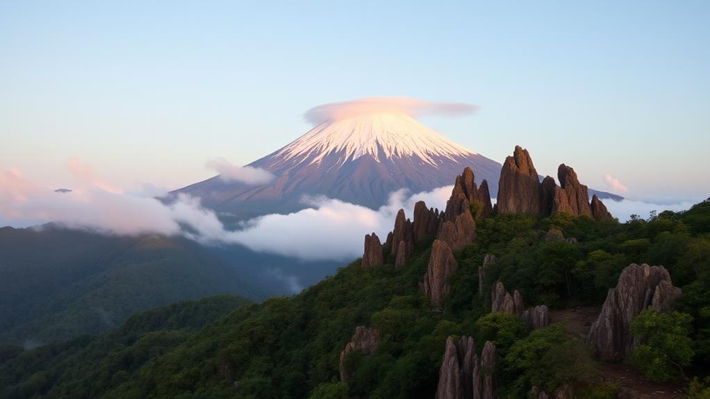
Mt. Kanlaon stands at an impressive 2,435 meters (8,694 feet) above sea level, making it the highest peak in Central Visayas and one of the highest volcanoes in the Philippines.
It's situated on Negros Island, within the Kanlaon National Park.
Geological Features
The active volcano features a prominent crater, approximately 800 meters in diameter, characterized by fumaroles and hot springs, indicative of its ongoing volcanic activity.
Mt. Kanlaon's geography is shaped by its composition of andesite and basalt rock, contributing to its unique characteristics as a stratovolcano.
Ecosystems and Vegetation
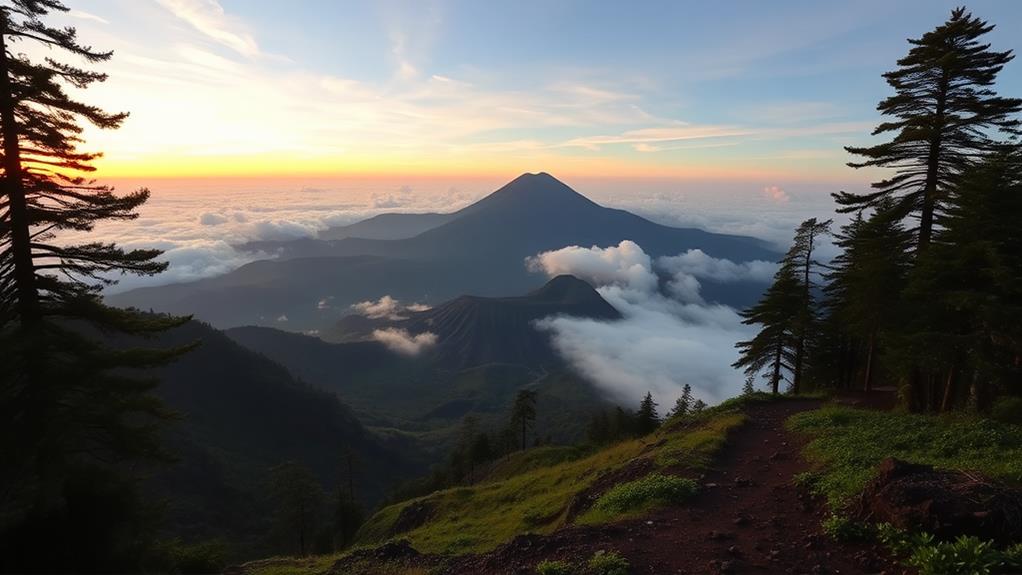
As you trek through the mountain, you'll encounter diverse ecosystems, including montane forests and grasslands.
The mossy forest, in particular, is a highlight, with its lush vegetation and unique plant species.
Summit Views and Conservation
As you ascend to the summit, you'll be rewarded with breathtaking views of the surrounding landscape.
Geological Features and Ecosystem
Mt. Kanlaon's Geological Features
Mt. Kanlaon, classified as a stratovolcano, exhibits unique geological features shaped by its composition and structure. The mountain's conical shape is primarily composed of andesite and basalt rock, which contributes to its distinct characteristics.
Geological Features:
| Feature | Description |
|---|---|
| Crater Diameter | 800 meters |
| Crater Depth | 400 meters |
| Composition | Andesite and Basalt Rock |
Mt. Kanlaon's Ecosystem
Mt. Kanlaon's ecosystem is diverse and home to a wide range of flora and fauna. The mountain supports 197 recorded species of plants, with high elevation forests dominated by gymnosperms and various epiphytes. As the highest point in Central Visayas, standing at 2,435 meters above sea level, Mt. Kanlaon serves as a critical habitat for endemic and endangered species, such as the critically endangered Visayan warty pig.
Trekking Experience and Climbing Routes
Mt. Kanlaon Trekking Experience
Embarking on a trek to Mt. Kanlaon is a challenging 2-3 day journey with an advanced difficulty rating of 7/10.
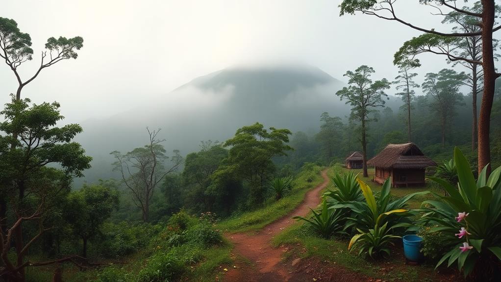
Day 1: Guintubdan Entrance Station to Campsite
The trek begins at the Guintubdan Entrance Station, taking an average of 5-7 hours to reach the first campsite, situated at approximately 2,000 meters elevation.
During this leg, you'll navigate diverse terrain, including dipterocarp forests and challenging trails like "Killing Me Softly".
Day 2: Campsite to Base Camp
From the campsite, you'll continue ascending, taking around 5-7 hours to reach the Base Camp, Hardin Sang Balo, where you can rest and replenish with a reliable water source.
Day 3: Base Camp to Summit-Crater
The final push to the summit-crater involves navigating rocky terrain and steep slopes, culminating in breathtaking views of the active crater and surrounding landscapes at an elevation of 2,435 meters, making Mt. Kanlaon one of the highest mountains in the region.
Ecosystems and Biodiversity
Throughout your trek, you'll experience a variety of ecosystems, showcasing the rich biodiversity of the area.
Preparation and Essential Gear
Packing Essential Gear for Mt. Kanlaon Trek
To ensure a safe and successful climb, pack essential hiking gear, including:
- Sturdy trekking shoes to handle challenging terrain
- Quick-drying clothing to adapt to changing weather conditions
- A waterproof jacket to combat rain and wind at high elevations
Hydration and Nutrition
Bring at least 2-3 liters of water to stay hydrated in humid and hot conditions.
Don't forget to pack trail food for energy and sustenance during the trek.
Overnight Camping Essentials
For overnight camping, consider renting a tent and packing:
- Sleeping bags to keep you warm during cold nights (temperatures can drop to around 10°C or lower)
- Toiletries for personal hygiene
- First aid kits for emergency situations
Navigation and Safety
Bring navigation tools such as:
- GPS to track your route
- Map to stay oriented
- Headlamp for early morning or late evening treks
Capturing the Moment
Don't forget your camera to capture the stunning volcanic landscapes of Mt. Kanlaon.
Cultural Significance and Hiking Opportunities
Mt. Kanlaon's Cultural Significance
Mt. Kanlaon is deeply rooted in local legends and folklore, making it a sacred volcano with significant cultural importance.
It is featured prominently in local festivals and events, which promotes tourism, community engagement, and environmental conservation awareness. This cultural significance is reflected in the volcano's importance in local traditions.
Hiking Opportunities Around Mt. Kanlaon
The area around Mt. Kanlaon offers a variety of hiking trails catering to different skill levels and interests.
Challenging routes like the "Killing Me Softly" trail appeal to adventure seekers, offering breathtaking scenic views of the surrounding landscapes.
Additionally, the region offers other hiking destinations, such as Mt. Tabayok and Mt. Pulag, providing a range of options to explore the natural beauty of the region.
Community engagement initiatives, like book donations for local elementary students, promote education and foster connections between hikers and the local populace.
Frequently Asked Questions
How Long Does It Take to Hike to Mount Kanlaon?
It takes 2-3 days to hike to the summit of Mount Kanlaon. This duration varies depending on your pace and chosen route.
On average, the ascent takes around 5-7 hours. However, you need to factor in additional time for scenic viewpoints, safety precautions, and potential wildlife encounters.
What Is the Difficulty Level of Mount Kanlaon?
Mount Kanlaon's difficulty level is 7/10. This rating indicates steep slopes, fallen trees, and thick vegetation that will test your physical fitness and endurance.
The trail conditions are tough, featuring steep inclines that can be slippery and muddy, obstacles like fallen trees that require climbing over or crawling under, and dense vegetation that can make navigation challenging.
To prepare, wear sturdy boots with good traction, bring trekking poles for balance and support, and wear protective clothing like long pants and a long-sleeved shirt to shield against scratches and bites.
Additionally, pack a first-aid kit with essentials like bandages, antiseptic wipes, and pain relievers, and bring emergency shelter like a lightweight tent or tarp in case of bad weather.
Is Mount Kanlaon an Active Volcano?
Yes, Mount Kanlaon is an active volcano.
This stratovolcano has a history of eruptions, with its most recent one occurring in 2006. Local authorities closely monitor Mount Kanlaon due to its potential for volcanic activity.
Its geological significance is evident in its massive 800-meter diameter crater, which is approximately 400 meters deep.
Is Mount Kanlaon in the Permanent Danger Zone?
Mount Kanlaon isn't entirely within the Permanent Danger Zone (PDZ).
The PDZ typically extends 4 kilometers from the summit of an active volcano. For Mount Kanlaon, the PDZ is limited to specific areas, including the summit and portions of the slopes.
The Philippine Institute of Volcanology and Seismology (PHIVOLCS) closely monitors volcanic activity and provides updates on the volcano's status.
Before trekking to Mount Kanlaon, it's essential to familiarize yourself with the latest guidelines and advisories to ensure a safe and responsible journey.
Local authorities and communities have emergency protocols in place to mitigate the ecological impact of volcanic activity.

